Advanced Navigation has demonstrated its indoor positioning technology at Castle Hill Station in Sydney, addressing a key accessibility challenge for commuters with vision impairments in GPS-limited environments.
The pilot, part of the Small Business Innovation & Research Program administered by the Office of the NSW Chief Scientist & Engineer, aimed to create a hyperlocal navigation system that enables accurate, smartphone-based guidance in underground public transport interchanges.
“GPS helps people find their way, but it comes with limitations. In underground train stations, for example, its performance significantly drops,” said Chris Shaw, CEO and co-founder of Advanced Navigation.
“This pilot program is a powerful example of taking our core navigation technology and creatively applying it to a high-impact, real-world problem.”
The pilot brought together Advanced Navigation, the Office of the NSW Chief Scientist & Engineer, University of Technology Sydney, Transport for NSW, and Sydney Metro. The company also consulted with vision-impaired commuters to better understand the navigation challenges in underground stations.
To address these gaps, eleven positioning systems were installed across the station’s concourse and platforms, using phased array ultra-wideband (UWB) and Bluetooth Low Energy (BLE) to precisely track smartphone locations within 10–30 centimetres.
Unlike GPS, which is often unreliable underground, the system provides uninterrupted location updates that enable users to confidently navigate complex features like lifts, platforms, and escalators.
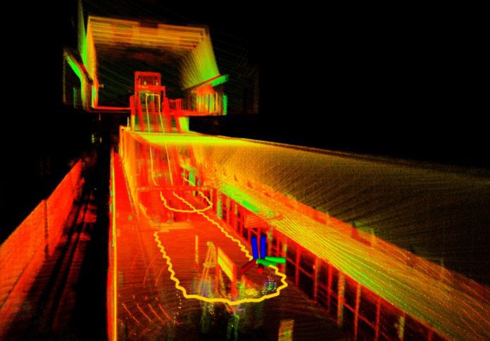
The performance of the system was tested using smartphones and a LiDAR-equipped backpack, with results confirming the technology’s high accuracy. The UTS LiDAR data was used to generate a 3D station map, which helped validate the indoor positioning system’s responsiveness under real-world conditions.
The NSW Chief Scientist & Engineer, Professor Hugh Durrant-Whyte, said, “Continuous research and development is key to driving innovative solutions to our most challenging problems.
Advanced Navigation’s pilot indoor positioning technology offers real promise to improve equity and access to public spaces for the visually impaired community.”
Manufacturing plays a key role in the company’s ability to scale and deploy this system. Advanced Navigation’s vertically integrated approach, which includes in-house manufacturing and R&D, enables the company to rapidly develop and customise systems for complex environments where GPS is unavailable – from tunnels and mines to remote industrial zones.
“Seeing this technology perform in such a demanding setting was incredibly rewarding,” Shaw added. “It shows what’s possible when you bring together innovative thinking, local manufacturing, and government-backed research.”
Advanced Navigation said it continues to explore opportunities to deploy its proprietary technologies in other GPS-denied environments.


