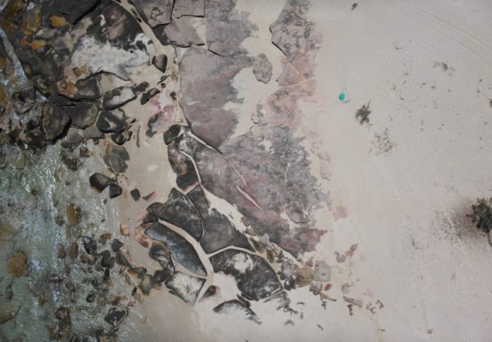
Drones and artificial intelligence are helping uncover ghost nets – abandoned fishing gear that poses a threat to marine life – along the remote coastline of the Gulf of Carpentaria, in a program led by Charles Darwin University (CDU).
The project, developed by CDU’s North Australia Centre for Autonomous Systems (NACAS) in collaboration with the Anindilyakwa Land and Sea Rangers, has so far surveyed nearly 84 kilometres of coastline within the Anindilyakwa Indigenous Protected Area (IPA), detecting 72 ghost nets of various sizes, from fragments as small as 50 centimetres to nets more than five metres long.
CDU PhD candidate Aliesha Hvala said the use of drone technology had proven to be a strategic and efficient tool for surveying remote regions in Northern Australia.
“Drones offer a user-controlled aerial monitoring solution, particularly suited to northern Australia, where survey efforts are often limited by accessibility and seasonality,” Ms Hvala said.
The Anindilyakwa IPA covers almost 1000 kilometres of coastline, an area typically monitored by helicopters – an approach that is costly and often disrupted by wet season conditions.
Ranger Manager Kirsten Eden said the partnership with CDU enabled a more efficient and cost-effective method of tracking marine debris.
“With CDU, we’ve successfully used drones to map the most affected beaches within the IPA, enabling more efficient planning, targeted net removal, and improved marine debris assessments using up-to-date data,” Ms Eden said.
The work is funded through the Australian Government’s Ghost Nets Innovative Solutions Grant, provided by Parks Australia.
Along with the aerial surveys, a custom-built vessel called Jarrangwa is being used by the Rangers to access hard-to-reach locations and remove the detected ghost nets.
Many of the nets identified by the project were buried in sand and largely invisible from the ground, requiring significant effort to extract. Some could only be removed using winches or teams of up to five people.
Anindilyakwa Land and Sea Ranger – Aquatic Biosecurity Officer Benjamin McArdle said drone and AI technology had markedly improved the team’s ability to locate and plan retrieval operations.
“High-resolution images combined with precise GPS coordinates of ghost nets have greatly improved the efficiency of trip planning,” McArdle said.
“It allows the team to map out routes and identify suitable beach access points before leaving the boat ramp.”
In addition to environmental monitoring, the project is helping build technical capabilities among Indigenous Rangers.
CDU delivered a nationally accredited Certificate III in Aviation (Remote Pilot) on Country, as part of the Fee-Free TAFE (NT) program supported by both the Australian and Northern Territory Governments.
Ranger Louise Mountford, who completed the training, said the experience had been challenging but rewarding.
“I wasn’t very comfortable doing it [flying drones], but I had the right people around me to overcome that and I’m very grateful,” Mountford said. “When you’re walking on the ground you can’t see everything, but with the drone it can help us see so much better.”
Eden said the training and technology had placed the team in a strong position to carry out drone mapping independently, but highlighted the need for further support.
“We will need funding opportunities for the initial purchase of our own drone equipment, continuous upskilling and training of Indigenous Rangers, and the resources to process and store the collected data on Country,” she said.
A new round of aerial surveying is set to commence in the coming weeks.


