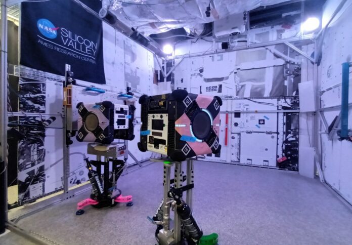
A cutting-edge 3D mapping technology developed by CSIRO, Australia’s national science agency, has made its way to the International Space Station (ISS).
Astronauts aboard the ISS will integrate this innovative technology onto Astrobee, a robotic platform courtesy of NASA, known for its versatility in undertaking various tasks across the station, the agency said in a news release.
Dr Marc Elmouttie, Research Group Leader at CSIRO, expressed the mission’s objective to produce intricate three-dimensional maps of the space station, surpassing previous levels of detail.
The primary aim is to streamline operations for astronauts by providing comprehensive spatial awareness.
“The goal for this mission is to demonstrate that our technology can provide enhanced 3D sensing and mapping for robotics systems on spacecraft, which may in future, perform autonomous caretaker operations on spacecraft,” Dr Elmouttie elaborated.
The technology amalgamates two state-of-the-art CSIRO innovations – Stereo-Depth Fusion and Wildcat Simultaneous Localization and Mapping.
This fusion promises to deliver superior-quality data concerning the station’s surroundings and the robot’s movements within the space environment.
Dr Elmouttie underscored the device’s capability to conduct thorough internal scans, aiding in inventory management and assisting astronauts and mission controllers in planning onboard activities effectively.
Developed in collaboration with Boeing and with the support of the ISS National Laboratory and NASA Ames Research Center, this payload leverages CSIRO’s rich legacy of pioneering remote mining operations and high-resolution scanning techniques for aerospace applications.
Should the multi-resolution scanning succeed in this demonstration, CSIRO intends to adapt the technology for various other space ventures.
This includes applications in environments requiring remote monitoring and management, such as the Moon-orbiting Gateway space station slated for the future.
Moreover, the team eyes potential applications for exterior hull scanning for Gateway, as well as lunar surface exploration aligned with NASA’s Artemis program.
“This is really a jumping-off point for us. Once we’ve confirmed this type of payload can do the job, then the sky’s the limit,” Dr Elmouttie said.
Boeing, committed to enhancing capabilities and ensuring safety for lunar missions and beyond, anticipates significant strides with this technology.
Scott Copeland, director for ISS Research Integration at Boeing, emphasized the convergence of crew and robotic tasks, underscoring the potential of the multi-resolution scanning technology.
Dr Ryan Reeves, technical director of Research and Innovation for the ISS National Laboratory, underscored the significance of testing and validating innovative technologies aboard the space station, fostering advancements in space commerce.
With the payload securely en route to the orbiting laboratory, the team eagerly awaits its first experimentation run, scheduled for deployment within the Japanese Kib? module.
The multi-resolution scanning payload was launched as part of SpaceX’s 30th Commercial Resupply Services-30 mission, facilitated by NASA, from Space Launch Complex 40 at Cape Canaveral Space Force Station in Florida.


